About Us
Mastering the art of optimization in geospatial data management
At GEODECI, we transcend mere workflow implementation. We cultivate the art of optimization. A seasoned enterprise in process automation, we bring depth and precision to every Geographic Information Systems endeavor.
We refine, streamline, and elevate geospatial data management, ensuring each decision, each workflow, each analysis reaches its optimal form. True innovation springs from seeing beyond the evident: transmuting intricate challenges into elegant, high-performance solutions.
Contact Info
Website
geodeci.xyz
contact@geodeci.xyz
Location
Paris, France
Phone
+33 7 54 47 59 86
Expertise
GIS and geospatial database solutions for fiber optics, transportation, and energy.
Advanced GIS solutions for the public sector and urban projects.
GIS modeling and data management for the petroleum and industrial sectors.
LiDAR surveys, drones, and high-precision calculations for surveyors and construction.
Projects
GIS & Data Infrastructure for Fiber Optic Networks
NGE INFRANET
Complete transformation of GIS database architecture for critical Région Auvergne Numérique fiber deployment project, serving over 500,000 households. Engineered advanced spatial routing algorithms and custom PostGIS geoprocessing functions that reduced fiber deployment planning time by 62%.
Automated GIS Data Processing for Telecommunications
SFR
Enterprise-grade GIS data integration platform that revolutionized network infrastructure management across 35,000+ cell sites nationwide. Spatially-optimized PostgreSQL/PostGIS architecture with custom spatial indices and parallel query optimization.
Renewable Energy GIS Analysis & Land Optimization
EDF Renewables
Comprehensive geospatial decision support system that transformed site selection methodology for utility-scale renewable energy projects across Europe. Multi-criteria spatial analysis framework incorporating 50+ weighted parameters.
Road Infrastructure Diagnostics & AI-based Analysis
Diagway VINCI
State-of-the-art AI-powered pavement condition assessment system deployed across 15,000+ km of European highway infrastructure. Custom CNN achieving 96.7% accuracy in detecting and categorizing pavement defects.
Geospatial Data Management for Oil & Gas
TotalEnergies
Enterprise geospatial data modernization initiative for global Exploration & Production division, encompassing operations across 50+ countries. Migration from legacy Oracle Spatial to high-performance PostgreSQL/PostGIS ecosystem.
Pipeline Detection & 3D Modeling
SONATRACH
Groundbreaking subsurface infrastructure mapping solution that revolutionized pipeline asset management across Algeria's challenging desert terrain. High-precision differential GNSS surveys with vehicle-mounted GPR arrays.
Services
Comprehensive GIS solutions tailored to your specific needs
Database Administration
Expert stewardship of databases: securing your data, accelerating queries, and ensuring seamless accessibility.
FME Advanced Workflow
Transforming data workflows through FME automation. Precision-engineered processes that run with clockwork efficiency.
Map Design
Crafting precise, eloquent maps that distill complex geographic data into clear foundations for strategic decisions.
GIS Manager
Orchestrating GIS initiatives to unleash spatial data's full potential, catalyzing innovation and operational excellence.
OpenSourcer
Harnessing open-source innovation to architect bespoke IT solutions, precisely calibrated to your enterprise requirements.
GIS Solutions
Weaving GIS technologies into your infrastructure, revolutionizing how you capture, analyze, and leverage geospatial intelligence.
Portfolio
Innovative solutions and methodologies we've developed
Latest Implementations
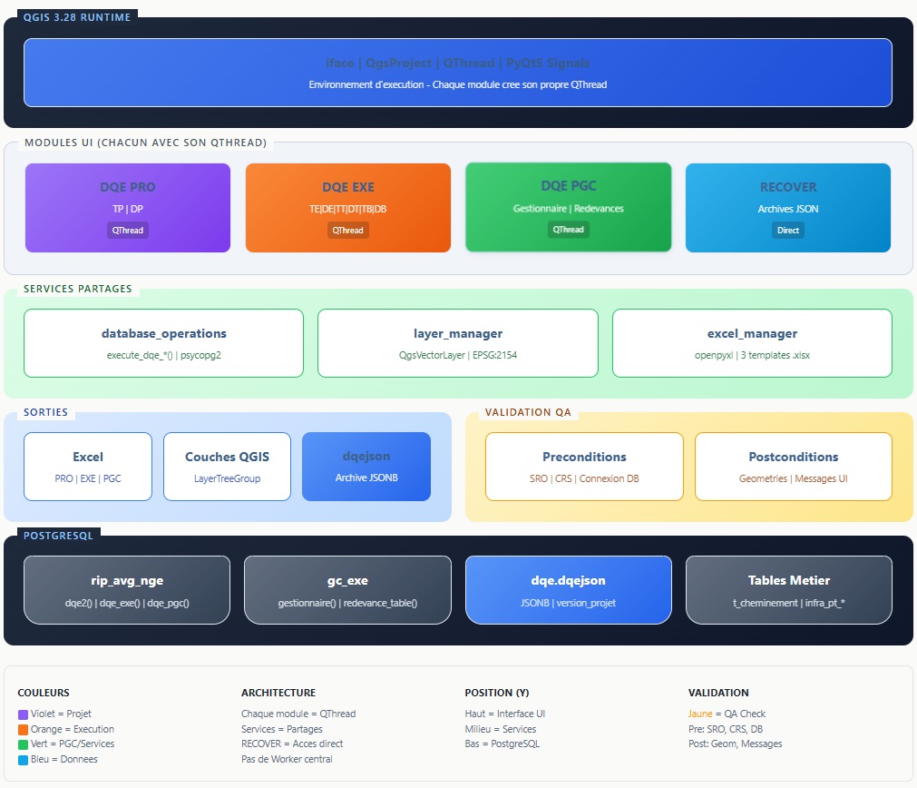
DQE Chargeur
Plugin QGIS professionnel pour l'automatisation des Devis Quantitatif Estimatif (DQE) des projets fibre optique. Génération Excel, visualisation cartographique, archivage et traçabilité. 2 ans de développement.
View Project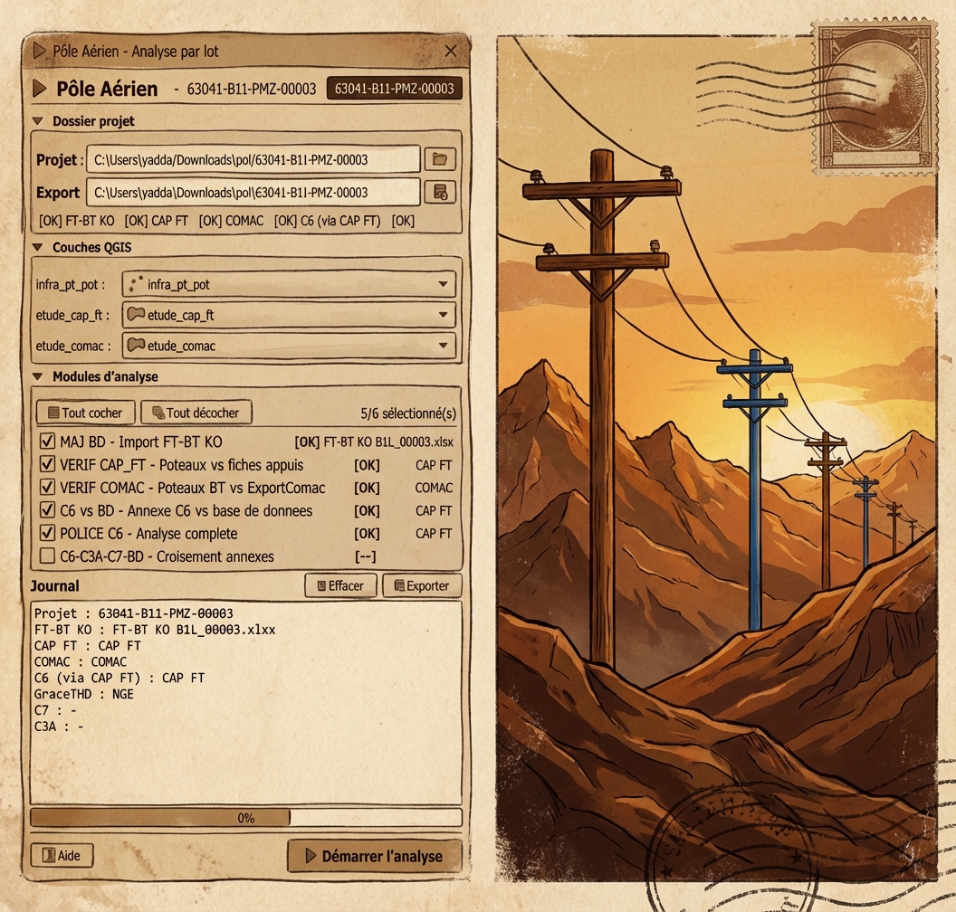
Pôle Aérien
Plugin multimodal QGIS dédié à la vérification des travaux sous-traitants sur les appuis aériens. Contrôle des appuis, câbles, capacités, normes et standards pour garantir la conformité des infrastructures aériennes.
View Project
QPooler
PostgreSQL Connection Pool for QGIS. Centralized connection broker reducing 15+ connections to 3-4, with 84% cache hit rate, role-based access control, and per-plugin metrics.
View Project
RecoverLand
Plugin QGIS d'audit local et de restauration chirurgicale des edits. Capture automatique de chaque commit (attribut, geometrie, suppression, insertion) avec delta storage (10-50x de reduction), buffer intelligent, journal SQLite sans serveur, et restore selectif avec controle de compatibilite schema.
View Project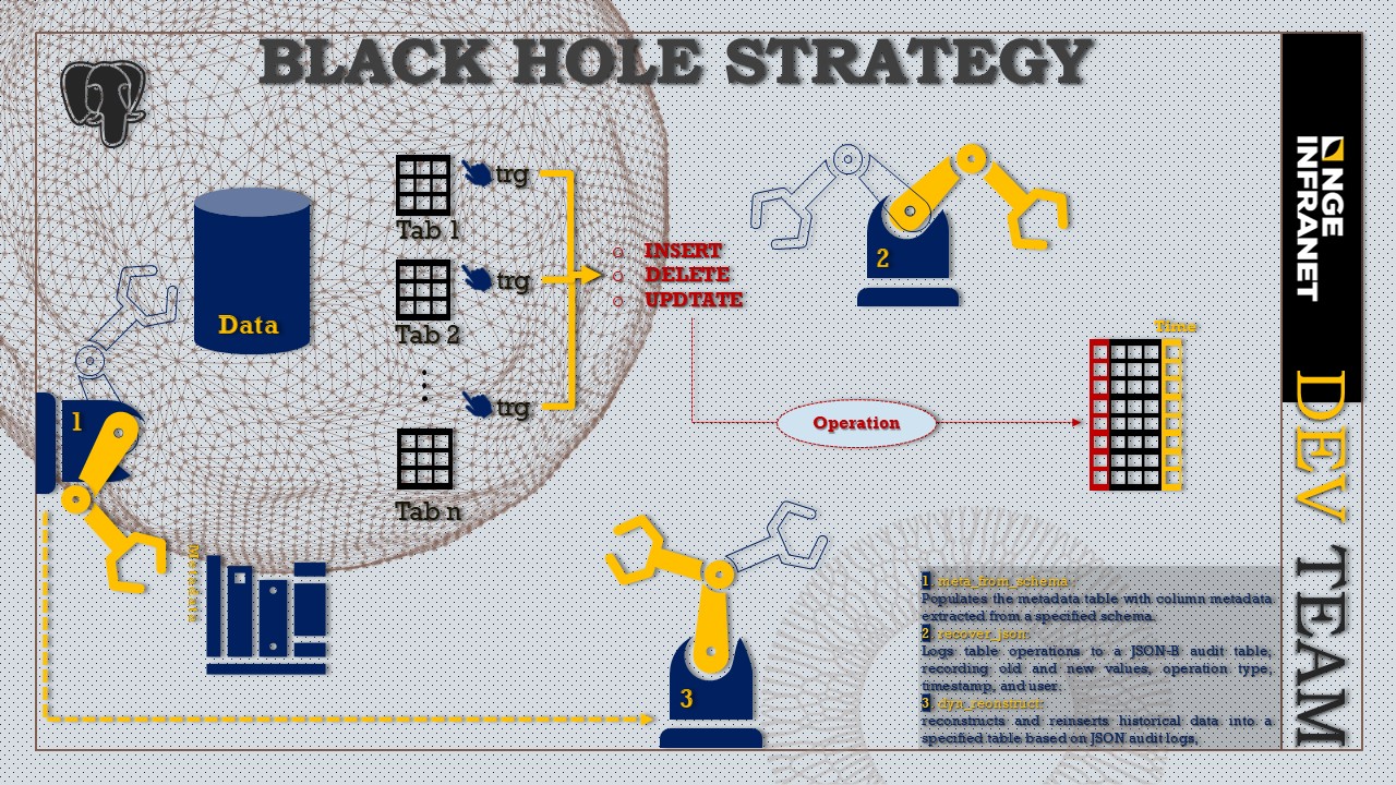
Black Hole Method
New data recovery strategy offering a smooth and efficient methodology for recording and reconstructing database operations.
View Project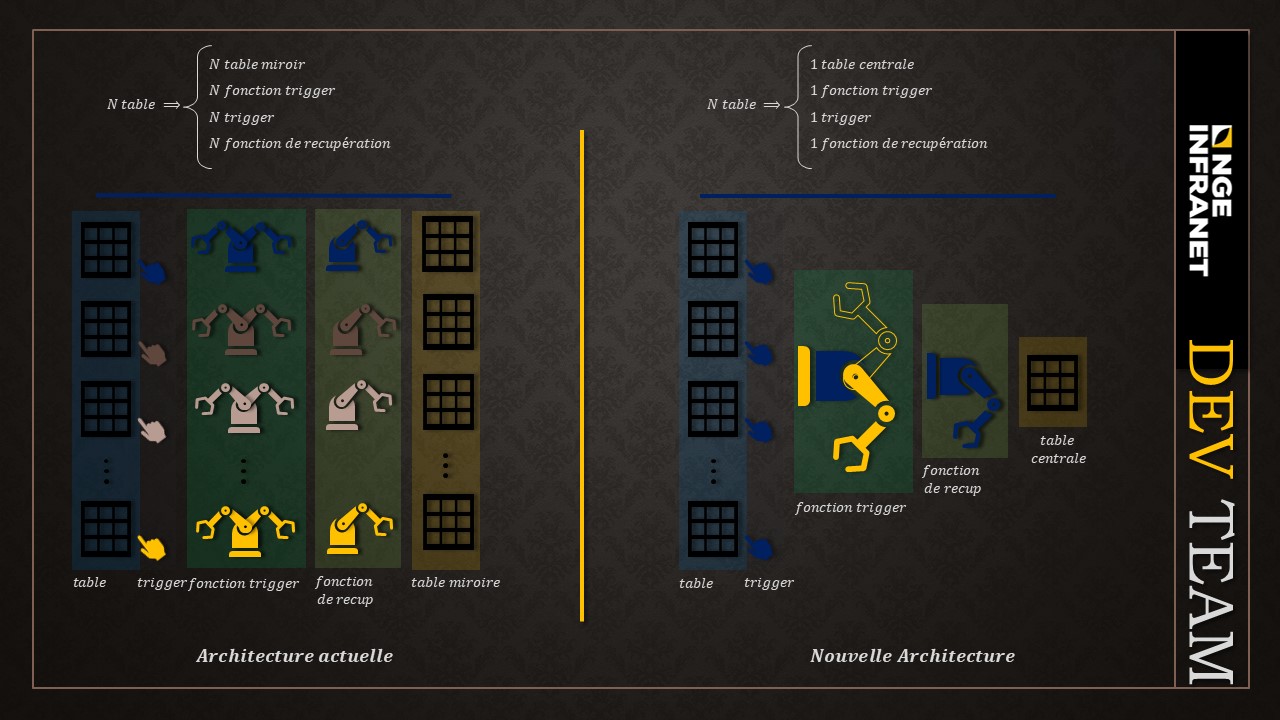
System Architecture
Architectural design for blackhole strategy.
View Project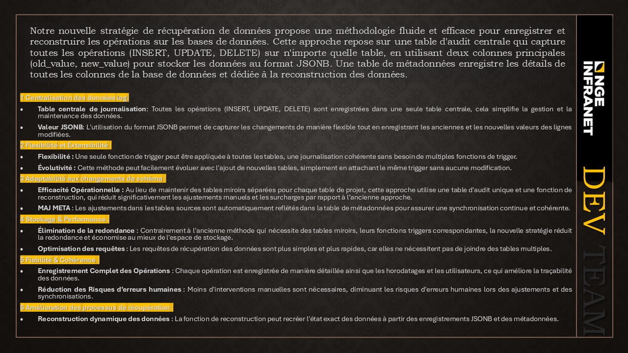
Architecture Advantages
Advantage analysis of blackhole strategy implementation.
View Project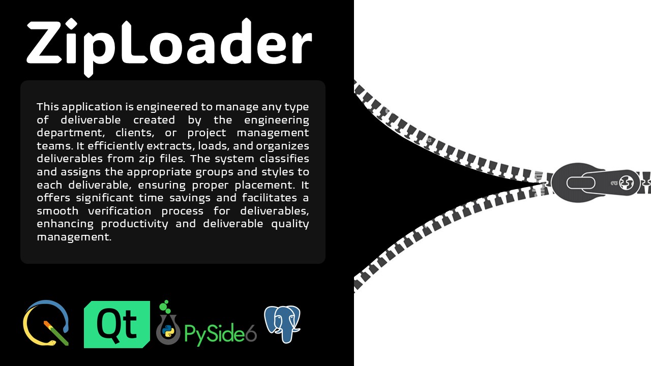
ZipLoader Project
Efficient data compression and loading system for large datasets.
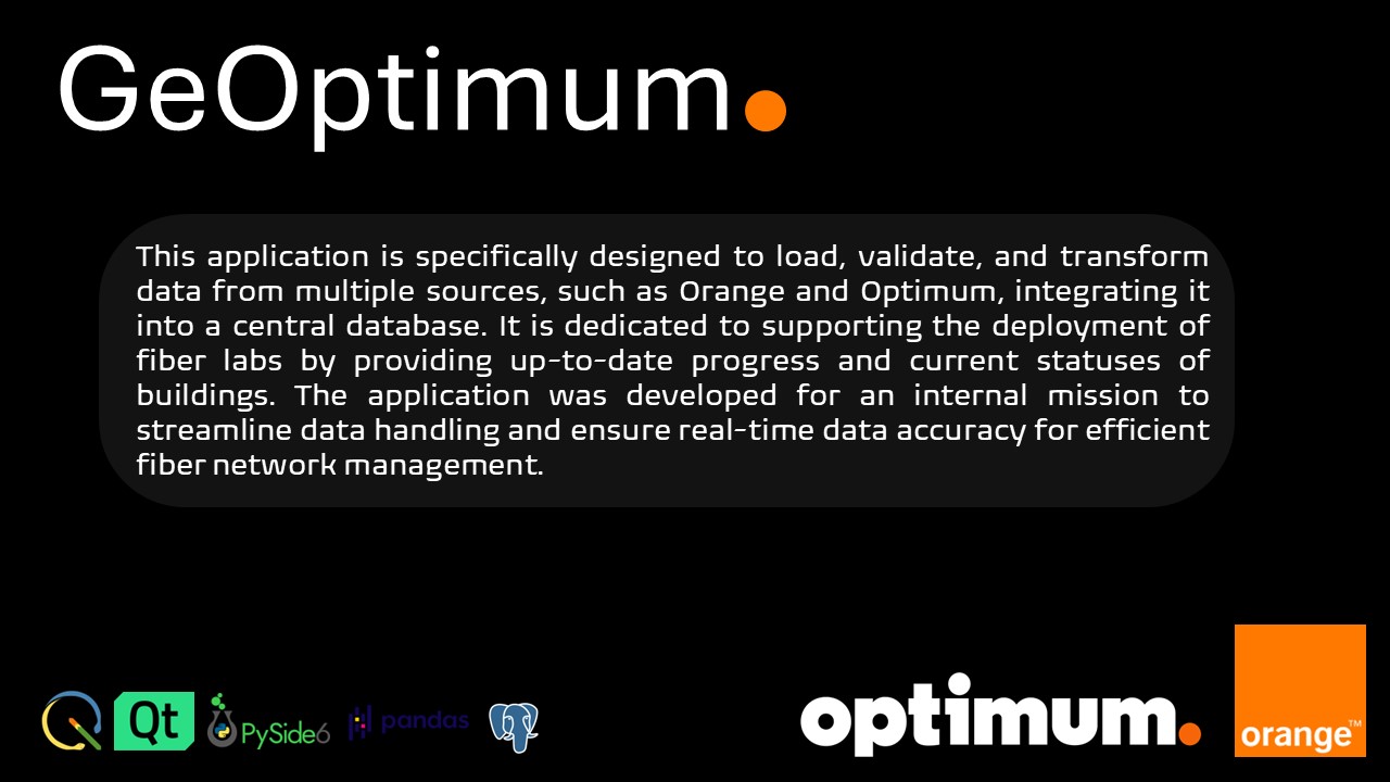
GeoOptimum
Geospatial optimization and analysis toolkit for complex spatial problems.
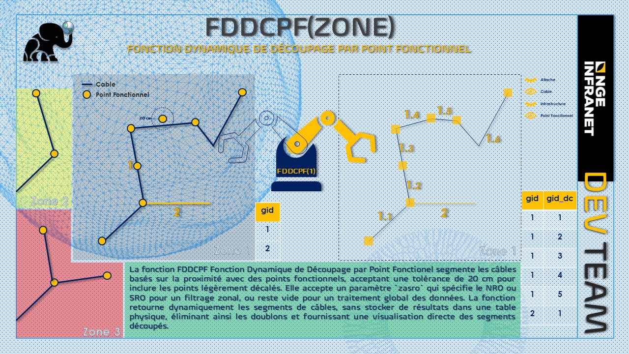
FDDCPF
Segments cables based on their proximity to functional points, with flexible criteria modes.
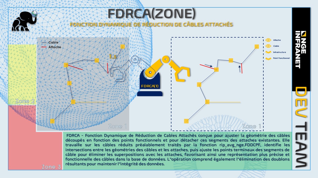
FDRCA
Adjusts cable geometry based on existing attachments ensuring geospatial data quality.
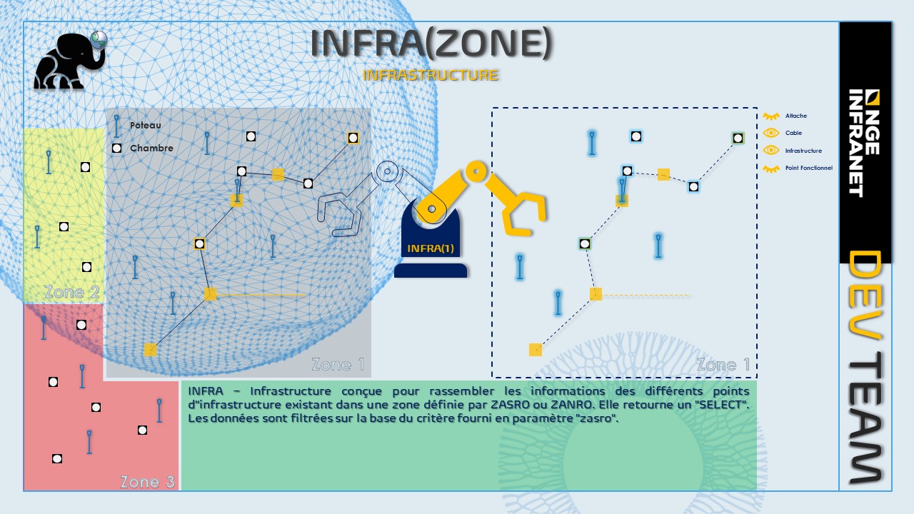
INFRA
Gathers information from various infrastructure points within ZASRO or ZANRO zones.
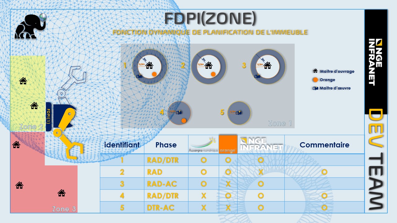
FDPI
Evaluates building status and progress within planning zones using zasro parameters.
Contributed To


Contact
Let's discuss your next geospatial project
Get in Touch
Ready to transform your geospatial data into strategic insights? We're here to help you navigate from data to decision.