1.6.0 · QGIS 4.2.1
RPot
Decide, pole by pole, what a subcontractor’s survey changes in the pole database.
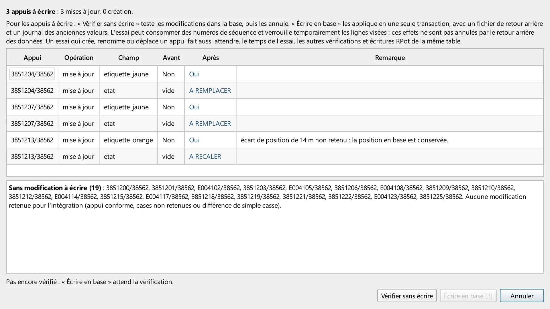
A subcontractor delivers a pole survey: Fiber shapefiles, a Fibees layer or the Fibees API. RPot compares each pole with the pole database and with GESPOT, the pole condition reference. It reads both without writing. Each pole gets a verdict, a score out of 100 and a list of proposed field changes, with their origin. Nothing is written before Intégrer, and only what the design engineer validated. The CSV export keeps the 84 usual columns. RPot adds five at the end: four for the audit trail (schema, neutralised cells, arbitrations, write journal) and the pole’s SRO.
Step 1 of 7
26 poles, sorted by score
Step 1. 26 poles, sorted by score. The RPot panel after one run on a 26-pole survey. Counters by class: 0 for manual control, 4 to check, 22 integrable. The list is sorted by score, lowest first. The selected pole, 3851204/38562, scores 95: two safe corrections are ticked, one value is left to check.
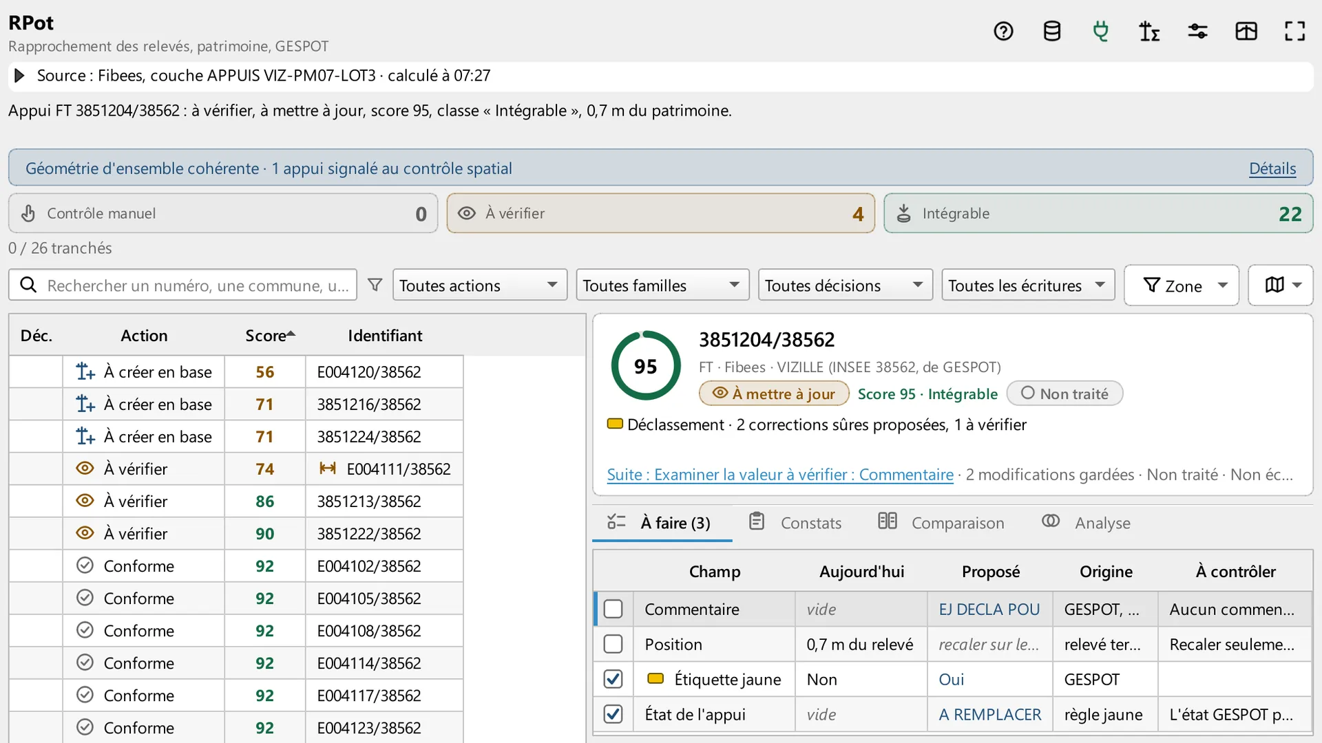
The RPot panel after one run on a 26-pole survey. Counters by class: 0 for manual control, 4 to check, 22 integrable. The list is sorted by score, lowest first. The selected pole, 3851204/38562, scores 95: two safe corrections are ticked, one value is left to check.
Arrow keys change the step. Escape closes full screen. Swipe on the image.
Sources for this page
Captured in QGIS 4.2.1 (Qt 6), French interface. The survey is synthetic: 26 poles with invented numbers, positions and attributes, on the code of one commune (INSEE 38562), under an invented project name. The pole database and GESPOT are replaced by an in-memory stand-in with the plugin’s database interface. No database was read or written, and the check without writing was not run. This is not client data.
Version and compatibility
metadata.txt: QGIS 3.22 to 4.99, Qt 6 declared, marked experimental. The README names QGIS 4.2 as the team’s version since October 2026 and keeps QGIS 3.40 LTR supported. In the reception run of 21 October 2026, 122 of 122 test suites passed on each of the two QGIS versions. Captured on QGIS 4.2.1, Qt 6. The panel is in French.
In-house tool. It is not published on plugins.qgis.org.
Designed and maintained by Youcef ADDA (GEODECI).
Decision Diagnostic
A short fixed scope. We name what costs money or blocks the work, and the first action to take.