Method
Deciding with reliable geographic data.
Where to build, what to protect, which network to renew, which site to keep, which deliverable to accept. Most territorial and network decisions have a geography. They commit budgets and liability. They increasingly have to be explained to elected officials, residents, a regulator or a court.
Author : Youcef ADDA (GEODECI) ·
The problem is rarely a lack of data. The data is not reliable, not traceable, or not tied to the decision it should inform.
The method is the same in every sector: start from the decision, write its criteria, make the supporting data reliable, keep the trail, and leave the choice to a person.
Why this is pressing
Dated obligations
PCRS and DT-DICT
Since 1 Jan 2026, where a local authority has produced a PCRS, network operators must use it in their replies to DT-DICT requests. Order of 15 February 2012, article 25, amended by the order of 26 October 2018.
ZAN
Halve the consumption of natural, agricultural and forest land over 2021-2031 compared with 2011-2021, then reach net-zero land take in 2050. Law no. 2021-1104 of 22 August 2021, articles 191 and 194, adjusted by law no. 2023-630 of 20 July 2023.
Renewable acceleration zones
Municipalities define renewable acceleration zones. Law no. 2023-175 of 10 March 2023 (APER), article 15, article L141-5-3 of the Energy Code.
Decisions are challenged more often
Consultation, appeals, review: a decision has to be explainable criterion by criterion.
More data, not more reliable data
Open data, surveys, contractor deliverables: volume grows. Consistency does not follow on its own.
AI speeds production up
That makes it more necessary to know who decides, on which data, and with which trail.
Five decisions, one pattern
In each case: a decision, criteria that are often implicit, data that is often scattered, and a human choice.
Authorities, planning
Where to build, what to protect (ZAN).
If it goes wrong : Appeals, land wasted.
Networks: water, energy, telecom
What to renew or survey first, which deliverable to accept.
If it goes wrong : Breaks, damage, penalties, rework.
Energy, renewables
Which site to develop, which to drop early.
If it goes wrong : Studies lost, projects stuck.
Land
Which plot to acquire first.
If it goes wrong : Public money poorly spent.
Contractors, engineering firms
Which drawing to deliver, at what quality.
If it goes wrong : Unbillable hours, rejections.
Four ways a geographic decision fails
- 01
Implicit criteria
The rule lives in one person’s head.
- 02
Non-conformant data
Incomplete fields, invalid geometries, duplicates, several versions.
- 03
No trail
Nobody can say who changed what, or recover the state the decision was made on.
- 04
Dependency
The decision depends on a closed tool or on a vendor, and cannot be rerun.
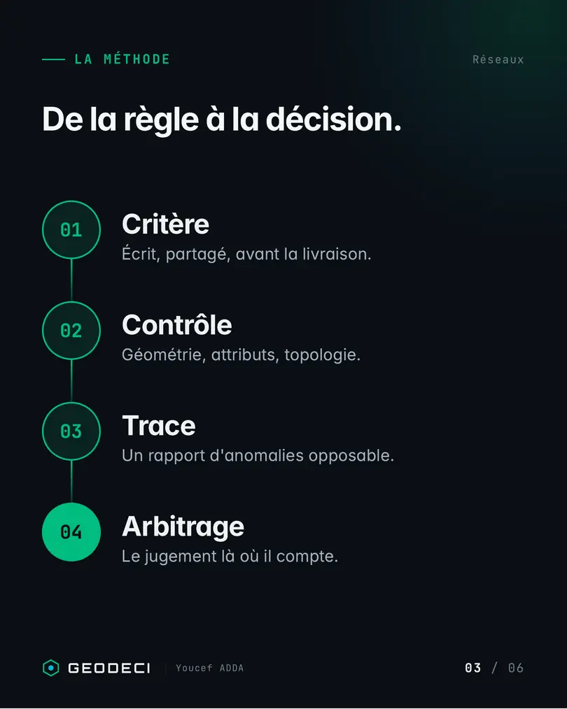
Decision, criteria, reliable data, trail, choice
- 01
Name the decision
One sentence, one owner, one deadline.
- 02
Write the criteria
Explicit, debatable, validated by the business.
- 03
Make the data reliable
Automatic conformity and geometry checks, on every delivery.
- 04
Keep the trail
A journal of changes, versions, sources and dates. Every result can be rerun.
- 05
Leave the choice to a person
The tool ranks and documents. The person decides and signs.
Open formats and tools (QGIS, PostGIS). Data stays with the client. Any use of AI is declared and reviewed.
What changes, sector by sector
- Local authorities. A maintenance or planning programme you can present to elected officials, criterion by criterion.
- Energy and networks. A ranked renewal or survey programme. Deliverables accepted on criteria you can stand behind.
- Planning and environment. A site analysis that can be rerun on each new area, and a transparent land-priority grid.
- Engineering firms. Repeatable production chains, at a constant quality.
Public proof
Three free and open-source QGIS plugins, on the official repository. Transformer 3.0.0 declares QGIS 3.28 to 4.99 (the README targets 3.44 or higher). RecoverLand 7.1.3 declares QGIS 3.40 to 4.99. Log Cleaner 2.2.2 declares QGIS 3.28 to 4.99. 6,244 downloads in total as of 23 Oct 2026 (plugins.qgis.org).
90 days
- 01
Days 1 to 30
Choose one priority decision, write its criteria, inventory the data.
- 02
Days 31 to 60
Automate the conformity checks. Put the trail in place.
- 03
Days 61 to 90
Produce the first documented choice. Measure time saved and gaps avoided. Decide whether to extend the method to other decisions.
Sources
- PCRS, regulatory context (docs.pcrs.beta.gouv.fr) (opens in a new tab)
- Order of 15 February 2012, DT-DICT (Légifrance) (opens in a new tab)
- Order of 26 October 2018 (Légifrance) (opens in a new tab)
- Law no. 2021-1104 of 22 August 2021, ZAN (Légifrance) (opens in a new tab)
- Law no. 2023-630 of 20 July 2023 (Légifrance) (opens in a new tab)
- Law no. 2023-175 of 10 March 2023, APER (Légifrance) (opens in a new tab)
- Official QGIS plugin repository (opens in a new tab)
GEODECI (GeoData & Decision Intelligence) helps organisations that decide with maps justify their choices: planning, environment and renewables, energy, networks, local authorities, construction, land. France, Belgium, Switzerland, Luxembourg.
Youcef ADDA (GEODECI)
Decision Diagnostic
A short fixed scope. We name what costs money or blocks the work, and the first action to take.