1.2.0 · QGIS 4.2.1
VTT
Decide which segments go out in the next tour, and take the field result back into the study database.
Before civil works, a fibre network operator sends crews to survey each planned route: ducts, chambers and poles. The study team has to know what is planned, done or blocked. Two people should not be sent onto the same segment. Each crew needs an offline map and its contacts. The field result has to come back without being typed again. VTT runs this cycle inside QGIS, on its own PostgreSQL schema.
Step 1 of 9
Inside QGIS 4
Step 1. Inside QGIS 4. VTT is a QGIS 4 plugin. One toolbar button opens the dial over the map. The segment layer is styled by visit state: to do, planned, achieved, blocked. The status bar reads EPSG:2154.
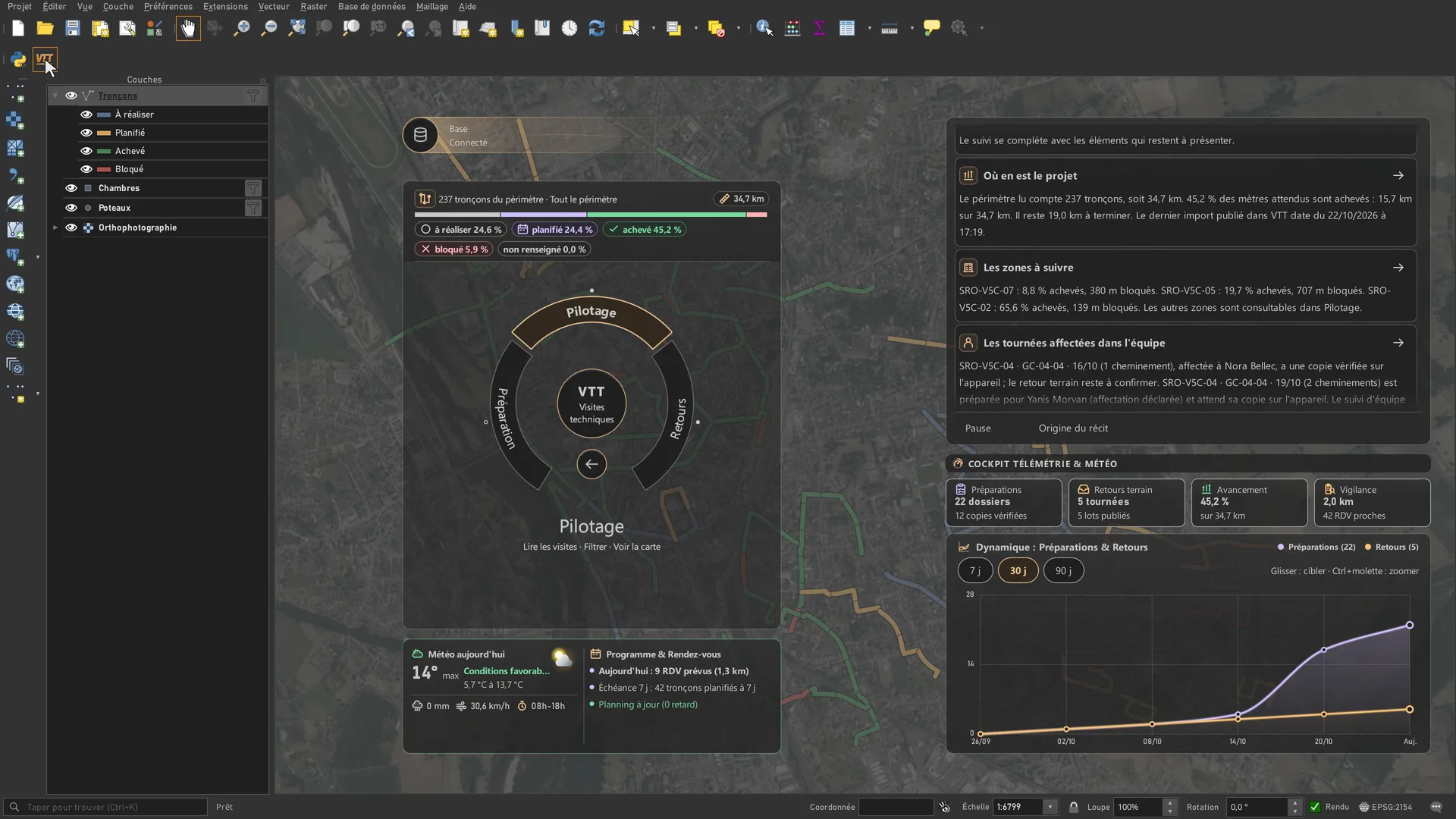
VTT is a QGIS 4 plugin. One toolbar button opens the dial over the map. The segment layer is styled by visit state: to do, planned, achieved, blocked. The status bar reads EPSG:2154.
Arrow keys change the step. Escape closes full screen. Swipe on the image.
Sources for this page
- Orthophotography, IGN BD ORTHO, Géoplateforme WMS, layer ORTHOIMAGERY.ORTHOPHOTOS, Licence Ouverte 2.0, received 22 Oct 2026 (opens in a new tab)
- Roads and railways, IGN BD TOPO, Géoplateforme WFS, layers BDTOPO_V3:troncon_de_route and troncon_de_voie_ferree, Licence Ouverte 2.0 (opens in a new tab)
Captured in QGIS 4.2.1 (Qt 6), French interface, project in Lambert-93 (EPSG:2154). The screens show the VTT 1.1.0 code, the QGIS 4 build just before 1.2.0. The QField screen is QField 4.3.6 for Windows, on a computer, not a tablet. The database is the synthetic one built for the GEODECI film, on public IGN data of a French town. Segments, tours, appointments and returns are invented. Team names are invented. This is not client data.
Version and compatibility
metadata.txt for 1.2.0: QGIS 4.2 to 4.5, Qt 6, flagged experimental. Server side: PostgreSQL with PostGIS. Field side: QField. USB transfer runs from Windows. Captured on QGIS 4.2.1 with the 1.1.0 code. The interface is in French.
In-house tool. It is not published on plugins.qgis.org.
Designed and maintained by Youcef ADDA (GEODECI).
Decision Diagnostic
A short fixed scope. We name what costs money or blocks the work, and the first action to take.