4.0.1 · QGIS 4.2.1
Pôle Aérien (ST-AIR)
Decide whether an aerial FTTH deliverable is ready to send, from one report per SRO.
On an aerial FTTH build, each pole is described several times: in the QGIS layers, in the CAP_FT pole sheets, in the COMAC exports and in the C6 annexes. These files are written by different people and drift apart. ST-AIR reads the SRO folder and the QGIS layers, and checks them against each other. It is the edition of Pôle Aérien for subcontractors. The subcontractor works on shapefiles and Excel files, with no database to set up.
Step 1 of 8
The deliverable, on the orthophoto
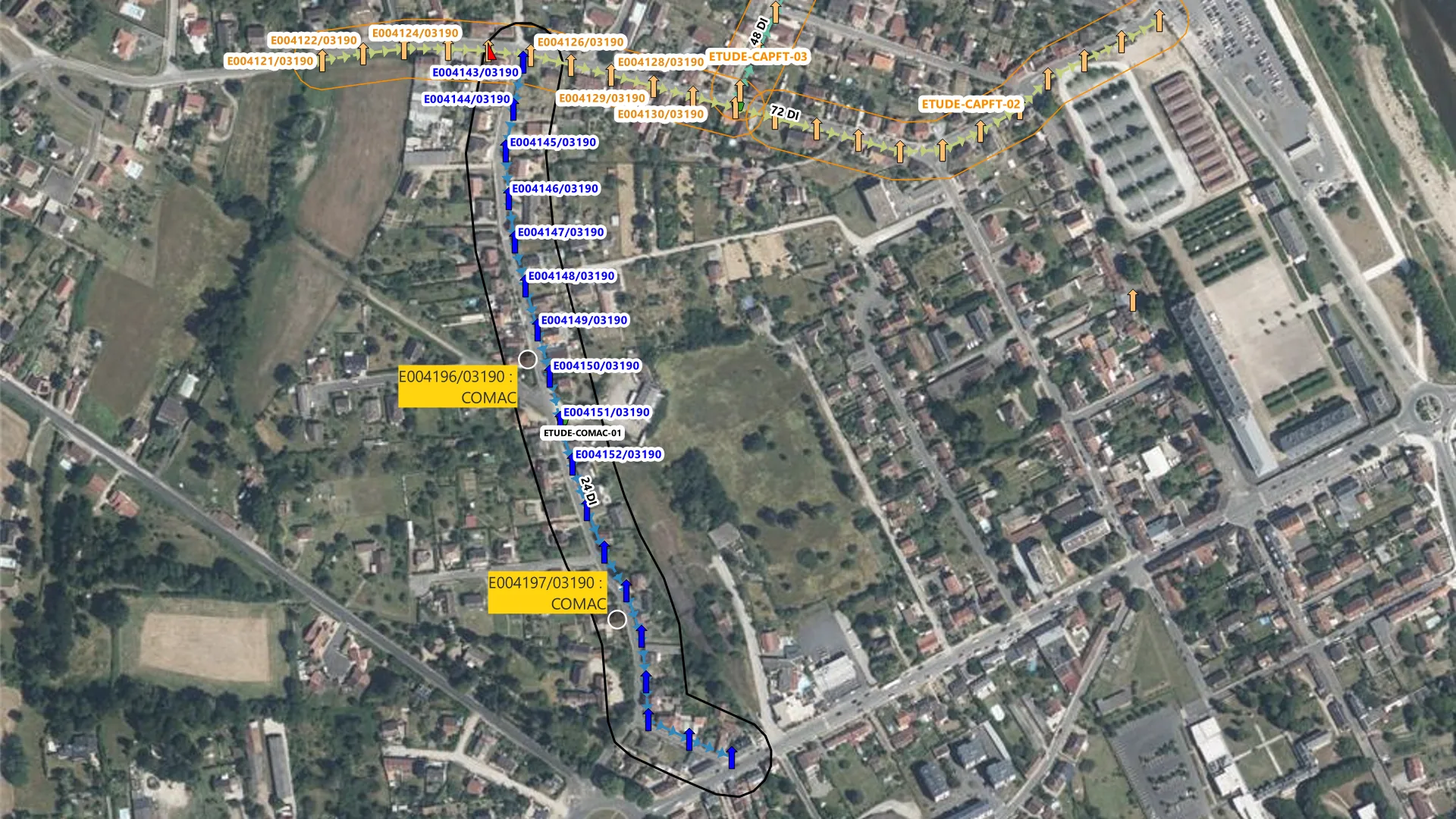
Step 1. The deliverable, on the orthophoto. Moulins, west of the Allier. 22 telecom poles on Rue du Pont Chinard, 9 on Rue des Magnots, 18 low-voltage poles on Rue des Bretins. Three CAP_FT studies in orange, one COMAC study in black. Cables of 72, 24 and 48 fibres. The styles are the plugin’s own.
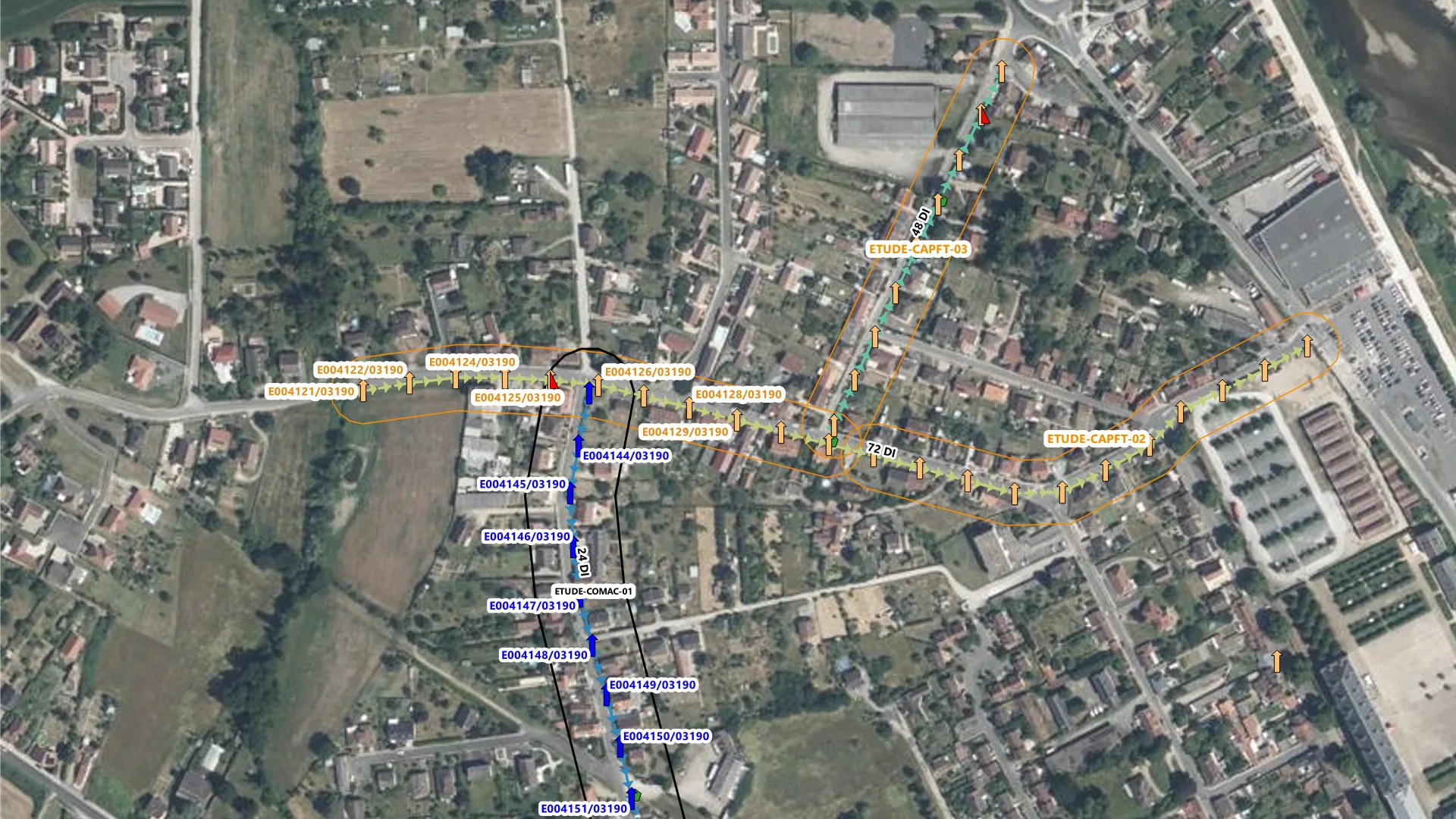
Moulins, west of the Allier. 22 telecom poles on Rue du Pont Chinard, 9 on Rue des Magnots, 18 low-voltage poles on Rue des Bretins. Three CAP_FT studies in orange, one COMAC study in black. Cables of 72, 24 and 48 fibres. The styles are the plugin’s own.
Arrow keys change the step. Escape closes full screen. Swipe on the image.
Sources for this page
- IGN BD TOPO V3, road segments (troncon_de_route), Géoplateforme WFS (opens in a new tab)
- IGN orthophoto, Géoplateforme WMS, layer ORTHOIMAGERY.ORTHOPHOTOS (opens in a new tab)
- ST-AIR source code on GitHub (opens in a new tab)
- ST-AIR documentation (opens in a new tab)
Captured in QGIS 4.2.1 (Qt 6), French interface, project in Lambert-93 (EPSG:2154). The network is synthetic. Poles, cables, studies, pole sheets and the COMAC export were generated for this tour along real streets of Moulins (Allier). Street centrelines come from IGN BD TOPO. The basemap is the IGN orthophoto. This is not client data. The SRO code uses the INSEE code of Moulins (03190) and is fictitious. The plugin styles one temporary layer with an icon font. For offscreen rendering, that label font was set to Segoe UI.
Version and compatibility
metadata.txt of ST-AIR 4.0.1: QGIS 3.28 to 4.99. Captured on QGIS 4.2.1, Qt 6. The dialog is in French.
In-house tool. It is not published on plugins.qgis.org.
Designed and maintained by Youcef ADDA (GEODECI).
Decision Diagnostic
A short fixed scope. We name what costs money or blocks the work, and the first action to take.